Kenyan mapping tool helps Haiti quake victims
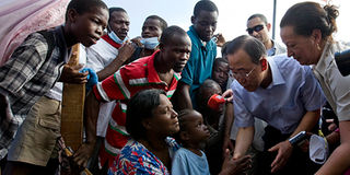
UN Secretary-General Ban Ki-moon (2nd R) speaks with displaced Haitians in front of the Haitian National Palace during his trip to Port-au-Prince January 17, 2010. A Kenyan online mapping tool — www.ushahidi.com — is being used by international organisations to mobilise assistance for the Caribbean nation. Photo/REUTERS
An online crisis mapping tool initiated and operated by Kenyans has been assisting families and friends locate missing persons, following the horrendous earthquake that hit the Haitian capital three weeks ago.
The online mapping tool — www.ushahidi.com — is also being used by international organisations to mobilise assistance for the Caribbean nation. These organisations include the United Nations Foundation, Plan International, Charity Water and the International Red Cross Society.
Other groups using the site include the Clinton Foundation, International Medical Corps, the Federal Emergency Management Agency and the United States Agency for International Development.


Working with the US State Department, the site’s developer’s introduced an SMS short code for subscribers on a Haitian network, to send text messages for free. In this way, eye witness accounts on the ground were easily reported.
Perhaps the most interesting thing about this tool is the fact that it is it operated by Kenyans in an informal setting from within coffee shops in Nairobi. Even so, their efforts have ended up impacting lives in a significant way thousands of miles away in Haiti.
Simulation exercise
Mr Erik Hersman, a co-founder of the crisis mapping tool explains that initial support came from two individuals in Colombia, who implemented the site in an earthquake simulation exercise in Bogota a few months earlier. The country has extensive experience in earthquake disaster response exercises.
The tool works by people around the world feeding information on the site using e-mail, text messaging as well as the social networking site Twitter. These firsthand reports are then placed on the site in real time.
“A group of 500 people from the International Network of Crisis Mappers are responsible for placing the information on the map,” says Mr Hersman. This is a network of specialists in technology and humanitarian response.
The frequency of these reports forms a pattern or trend on the map which gives an idea about the real situation on the ground in Haiti. For instance, a red dot appearing on the map is an indication of a crime being committed at the specified locality in Haiti.
The people’s eye-witness accounts of what is going on are then used to provide useful information about food shortages, medical supply needs and the state of security.
“These specialists assess the incoming information based on the geography of Haiti. And by placing the information on the site, other people and organisations on the ground in Haiti pick it up and respond in accordance with the specific need of the place,” explains Mr Hersman.
All too often unscrupulous individuals take advantage of disasters, to benefit themselves. The same thing happened in the aftermath of Hurricane Katrina in the US. Media outlets have been particularly keen to warn people about bogus sites inviting donations that would go toward humanitarian assistance in Haiti.
However, Hersman maintains that www.ushahidi.com is way above board, otherwise it would be impossible for them to partner with international organisations. He explains that they are funded by private foundations.
Mr Hersman together with Mr David Kobia, a software developer, co-founded www.ushahidi.com, in January 2008, in the middle of Kenya’s post-election chaos, in the wake of the disputed elections. He and his colleagues were located in violent hotspots in Nairobi and Eldoret at the time.
The site was deployed two days later to assist Kenyans get vital information on the extent and spread of the election violence. It was, therefore, instrumental in keeping people safe, by helping them avoid danger zones.
Critical information
And now two years down the line, the same crisis mapping tool is playing a central role in providing critical information to people and organisations around the world. “We came up with software that allows Haitians to ask for help,” says Mr Hersman, adding that the tool runs 24/7.
Since many organisations provided other forms of data, says Hersman, he and his colleagues wanted to do something different. “We wanted to build a system which wananchi (citizens) can use to say something,” he says.
In the same vein, Mr Hersman and his colleagues came up with www.hatari.co.ke, which Nairobi residents used to upload video and information following the violent demonstrations over the deported Muslim preacher Abdullah al-Faisal in January.