Why Kisumu residents fall victim to perennial floods
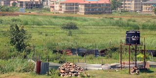
A wetland bordering Lolwe estate in Kisumu County on June 6.
What you need to know:
- Cultural beliefs on land ownership have often upset efforts to create awareness and the necessary interventions.
- Most residents are hesitant to leave their ancestral land. Until the next flood strikes.
Wetlands in Kisumu City are now under increased threat of loss as private developers encroach on the reserves in a scramble for space for construction.
Where wetlands previously were, modern, high-rise office and residential buildings have taken over as urbanisation eats nature's lunch. In other sections of the county, agriculture is leading to loss of these water ecosystems on a scale not witnessed before.
Wetlands are valuable for protection against floods and encroachment onto them exposes human settlement and farms to the wrath of Mother Nature. In recent months, for instance, more than 1,500 households have been affected by floodwaters that are common whenever it rains in Kisumu and the neighbouring counties.
The county has multiple areas identified and preserved as wetlands, including Dunga, Ombeyi, Nyando and Kusa. Others are Namthoi, Koguta, Chiga and Kisat.
Despite having the second largest freshwater lake in the world, Kisumu County has not gazetted any of these wetlands. This gap has exposed the resources to takeover by private developers through grabbing.
County chief officer For Environment and Natural Resources Owino Ochieng says wetlands hold a lot of water, making them habitat for aquatic life and wildlife.
“Many people have encroached these areas and built pavements and houses. This prevents the wetlands from performing their natural function well,” says Ochieng.
He warns that with this destruction, flooding is inevitable.
“Most of our county is low-lying, making it vulnerable to floods. Ahero plains that were previously under rice have slowly been converted into residential areas,” he adds.
Director of Freshwater Systems Research at the Kenya Marine Fisheries and Research Institute (KMFRI), Dr Christopher Aura, says wetland zones include areas of mash, swamp, peatland and water bodies with depth not exceeding six metres.
“With the invasion of wetlands, humans endanger the wetland biodiversity because some of the wetlands are wildlife habitats and fish breeding areas. This encroachment also increases the risk of water pollution,” warns Dr Aura.
He says wetlands in the county play a vital role of "sieving" river water before it drains into the lake. He observes that rivers carry tonnes of debris from upstream and that without the wetlands, the lake would be heavily contaminated.
“Encroaching onto these areas shrinks the buffer zone," he indicates even as he calls for sensitisation of local communities on sustainable use of wetlands for economic gain.
“We have clear wetland regulations and policies in the country. People are obligated to follow them. You should know up to what point within a wetland you can cultivate. It is also important to understand the procedures of putting up any structures near wetland areas,” Dr Aura advises.
The county has now started to gazette its wetland resources. "We will ensure people are educated and awareness is created to protect our wetlands,” Ochieng says.
Magnum Environmental Network Chairman Michael Nyanguti claims that despite knowing about the encroachments, the devolved unit is culpable for approving building plans in these sections.
“We have laws in place. What is lacking is enforcement of the laws. Is the county corruptible? How do you explain the open impunity and encroachment by establishments such as Kiboko Bay, Hill camp, Yacht club, the Beach hotel at Dunga?” The environmentalist wonders.
But country director of the National Environmental Management Authority Leonard Ofula puts the blame of floods in Kisumu on runoff water from Nandi Hills. Wafula proposes the construction of a dam upstream to ease the force and volume of water flowing downstream.
"This will ensure that by the time the water reaches the basin and Kano Plains, its power of destruction is reduced," he says.
Meteorology experts agree. Siaya County Director of Meteorological Services Domnick Arodi tells Healthy Nation that most people ignore weather forecasts even when they are between 80 and 90 per cent accurate.
“Normally, we issue warnings early enough. The ongoing rainfall had been predicted in February. If residents had heeded our warning and moved to higher grounds, widespread damage would be avoided,” Arodi says.
River Nyando in the county is notorious for flooding and destroying homes, farms and critical infrastructure nearly every year. The river has its catchment in Nandi, Kericho Muhoroni and Nyando areas.
Cultural beliefs on land ownership, he says, have often upset efforts to create awareness and the necessary interventions. Most residents are hesitant to leave their ancestral land. Until the next flood strikes.
Besides awareness, the county is planning to start dredging rivers known to burst their banks during the rainy season.
“Most of the rivers in the county have silt deposits that hamper water flow, leading to overflows," Arodi explains.
He adds that other man-made activities such as diverting river water for farming could help to reduce the frequency and severity of floods.