Kiambu county at a glance
GEOGRAPHY
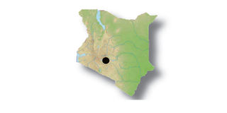
Location: Located in central Kenya, it borders Murang’a county to the North and North East, Machakos county to the East, Nairobi and Kajiado counties to the South, Nakuru county to the West, and Nyandarua county to the North West.
Area (Km 2): 2,543.4 Km 2


Climate/Weather: Temperatures range from a minimum of 12.8°C to a maximum of 24.6°C with an average of 18.7°C. The average rainfall is 989mm per annum.
Road Network: Bitumen Surface (1,358 km), Gravel Surface (682.6 km), Earth Surface (430.1 Km)
Key National Monument(s): None
---------------------------------------------
POPULATION
Population: 1,623,282 (Male – 49%, Female - 51%)
Population Density: 638 people per km 2
National Percentage: 4.20%
Annual Growth Rate: 2.56
Age Distribution: 0-14 years (34.5 %), 15-64 years (61.9 %), 65+ years (3.6%)
Number of Households: 469,244
---------------------------------------------
GOVERNMENT
County capital: Kiambu Town (proposed)
Number of Constituencies (2010): 8 (Githunguri, Gatundu North, Gatundu South, Limuru, Lari, Juja, Kiambaa, Kabete)
Registered Voters: 699,303
National percentage: 5.5%
Number of Districts (2009): 11 (Lari, Limuru, Githunguri, Kiambaa (Kiambu East), Kiambu West, Kikuyu, Thika East, Thika West, Ruiru, Gatanga, Gatundu)
Number of Local Authorities (2010): 8 (Municipal councils of Kiambu, Limuru, Thika, and Ruiru, County Councils of Kiambu and Thika, Town Councils of Kikuyu and Karuri)
---------------------------------------------
ECONOMICS
Poverty Level: 25% (Kiambu District) and 48% (Thika District)
Age Dependency Ratio: 100: 62
Resources: Arable Land, Forests, Water Falls.
Tourist Attractions: Mau Mau Caves, Paradise Lost, Chania Falls and Fourteen Falls, Mugumo Gardens, Christina Wangare Gardens.
Financial Services: Seven commercial banks, eight micro-finance institutions.
Main Economic Activities/industries: Farming, Food Processing, Manufacturing (Leather), Mining (Carbacid), Textile (Cotton), Motor Vehicle Assembly, Wholesale and Retail trade.
Agricultural products: Pineapples, Tea, Coffee, Wheat, Macadamia Nuts, Poultry, Horticulture, Dairy, Fish.
---------------------------------------------
EDUCATION
Number of Institutions (2007): Primary (1,135), Secondary (373)
Primary: Enrolment (291,765)
Teacher to Pupil Ratio: 1: 43 (Public Schools)
Secondary: Enrolment (73,831)
Teacher to Pupil Ratio: 1:20 (Public Schools)
Tertiary: More than 15
Adult Literacy Classes: Enrolment: Over 9,337 (Central Province)
---------------------------------------------
HEALTH
Health Facilities: District Hospitals (4), Sub-District Hospitals (3), Dispensaries (108), Health Centres (29), Medical Clinics (170), Nursing Homes (9), Maternity Homes (1), Others (22)
Doctor to Population Ratio: 1:25,000 (Kiambu District), 1:21,940 (Thika District)
Infant Mortality Rates: 7/1000 (Kiambu District), 63/1000 (Thika District)
Under Five Mortality Rates: 8/1000 (Kiambu District), 36.7/1000 (Thika District)
Prevalent Diseases: Malaria, Respiratory Tract Infections, Intestinal Worms, Broncho-pneumonia.
Notable Hospitals: Kiambu District Hospital, Thika District Hospital, Immaculate Heart of Mary Hospital.
Compiled by Institute of Economic Affairs: [email protected]


