Intricacies of urbanisation within community lands
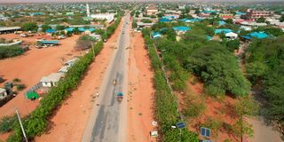
An aerial view of Mandera Town early last year.

The northeastern frontier counties, in the throes of urbanisation, face a pivotal juncture as market-driven demands for urban land transform pastoral landscapes into burgeoning settlements. The need for a robust land policy, strategic land use plans and legislation becomes imperative to manage this evolution effectively.
Delineating urban boundaries, particularly in unregistered community lands, is a significant factor in the intricate interplay between urbanisation and community land dynamics. The Urban Areas and Cities (Amendment) Act, 2019 provides a structured framework for delineating urban areas.
With cities and municipalities at the apex, it mandates the delineation of towns and market centres to demarcate the limits of urban expansion. These boundaries, crucial for fostering compact urban development, also safeguard rich rangelands and fragile ecosystems from unplanned settlements, reducing the cost of providing essential urban infrastructure.


Integrated planning
Community participation is paramount in planning, as outlined in Article 176(2) of the Constitution. Counties are mandated to decentralise functions efficiently, involving smaller governing units.
But in these counties, urban centres lack clear boundaries, hence ambiguity. Delineation is a cornerstone for integrated planning, mitigating conflicts and enabling equitable resource distribution. Notably, it has nothing to do with, nor does it influence, the administrative and electoral boundaries.
The Community Land Act, 2016 vests community land in the “community”, defined as a consciously distinct and organised group of users of community land who are citizens of Kenya and share any of the following attributes: Common ancestry, similar culture or unique mode of livelihood; socioeconomic or other similar common interest; geographical space; ecological space; or, lastly, ethnicity.
In Mandera, for instance, this Act takes centre stage as the community becomes a custodian of its land, influencing delineation and ensuring sustainable land use practices. The unregistered community land is vested on the communities of Mandera and held in trust by the county government in line with Article 63 of the Constitution.
Further, the management and administration of community land is guided by the Act, and Regulations gazetted in 2017; the law’s Section 22 (1) allows for conversion of community land to public land via compulsory acquisition, transfer or surrender.
Urban development
Leveraging powers under the Urban Areas and Cities Act, through an ad hoc committee facilitated by the county government, the meticulous process involves stakeholder consultations and technical standards. Being among the pioneers in urban boundary delineation, Mandera thus sets a precedent for sustainable urban development. This process, inclusive and community-driven, not only aligns with constitutional mandates but also ensures the judicious use of land resources, fostering harmony between urban expansion and the preservation of community and ecological integrity.
In navigating the delicate balance between urbanisation and community interests, Mandera exemplifies a model that other counties could emulate to usher in a new era of sustainable land use planning.
Mr Alio is the CECM for Lands in the Mandera County government. [email protected].