Second review of boundaries time-barred

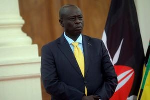
IEBC Chief Executive Officer Marjan Hussein Marjan in Nairobi on March 14.
Kenya’s administrative and political boundaries date back to the scramble and partition of Africa, at the Berlin conference of 1885, where European Imperialists shared the African continent.
From the African perspective, almost all of today’s political maps of Africa were drawn in the 19th and early 20th centuries at negotiation tables in various European capitals. The endeavour was only partially successful, though only few areas were left with no boundary definition.
In 1962, the colonial government established the Regional Boundaries Commission, to divide Kenya into six regions and the Nairobi area. People were given their wish to be associated with a region.
The Independence Constitution of 1963 divided the country into 40 districts and Nairobi area, in seven provinces and Nairobi area. Notably, the Districts and Provinces Act No. 5 of 1992 is the only Act that provides for the names and boundaries of the Districts and Provinces: 46 Districts and Nairobi area. The sub-location forms the smallest unit for the ward, constituency, county and state boundaries.
The first electoral boundaries review, under the Independent Review Commission (Kriegler Commission) report, led to the establishment of the Interim Independent Boundaries Review Commission (IIBRC) in May 2009. The Independent Electoral and Boundaries Commission (IEBC) used the IIBRC and JLAC report for delimitation. Parliament published the National Assembly Constituencies and County Assembly Wards Order on March 6, 2012.
Concluded by next month
The IEBC should conduct boundary delimitation every 8-12 years preceding the current delimitation, a year to the general elections with the created electoral units applied in the subsequent election.
With the latest review, gazetted in March 2012, the next should be concluded by next month, according to the law and the IEBC Boundaries Review Operations Plan 2019-2024.
But this is besieged by myriad challenges, ranging from lack of comprehensive legal framework, operational and logistical, boundary technology,socioeconomic, politico-cultural and security factors. The 2019 census not being aligned to the existing electoral units due to the creation of later sub-locations is also a challenge.
Since the expiry of the term of the Chebukati-led electoral commission in January last year, the state of affairs at the country’s election management body has been somewhat skeleton operations with the Hussein Marjan Hussein-led secretariat unable to execute any key decision-making which require policy, overight and strategy direction—such as by-elections and recruitment of personnel.
The National Dialogue Committee (NADCO) report proposal for Parliament to amend Article 89 of the Constitution is plausible. It’s time a conversation on the boundaries review crisis is activated and the IEBC, though not properly constituted, beat the drums of the time-barred review and engage primary stakeholders on the unfolding situation.
Better late than never.
- Mr Harar is an elections manager at IEBC. [email protected].


