Scientists turn to GIS in push to end epidemic by 2030

What you need to know:
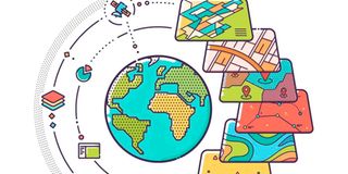
The use of Geographical Information Systems is now a key technological tool being used to inform policies in line with HIV/AIDS.
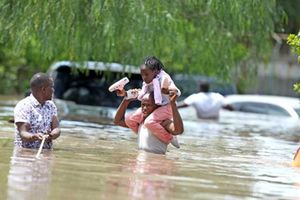
In Kenya, a study conducted in Kisumu County last year helped in informing policies on quality care for people living with HIV.
Scientists are now embracing the use of maps and specific location tools to help in prevention and quality care for people living with HIV/AIDS and those at high risk of getting infection.
This technology backs the existing HIV/AIDS interventions such as campaigns on testing, use of pre-exposure prophylaxis abstinence, and use of condoms.
The use of Geographical Information Systems (GIS) is now a key technological tool they are using to inform policies in line with HIV/AIDS.
The US Centre for Diseases Control and Prevention explains that GIS are computer-based tools used to store, visualise, analyse, and interpret geographic information. “These data include anything that can be associated with a location on the globe, or more simply anything that can be mapped,” it explains.
In a new study published by the Lancet, scientists from China have used the approach to inform a precise public health approach in support of people living with HIV/AIDS and those at risk of being infected.
“The transmission linkage between some cities geographically distant from each other was even stronger than between cities close to each other, which implies that local health sectors in those distant cities may increase information exchange for better launching joint interventions,” revealed the Lancet study.
In Kenya, a study published in the scientific journal, F1000Research, last year, whose aim was to help improve the strategy of taking care of patients living with HIV/AIDS and are not on any active Antiretroviral Therapy in Kisumu County, also helped in informing policies on quality care for people living with HIV.


Dr Kevin Rombosia, a geospatial epidemiologist who was part of the study, tells Healthy Nation that new and increasing geographic application systems should be embraced in public health programmes.
The strategy
This is in line with the joint United Nations Programme on HIV/AIDS 95-95-95 strategy whose aim is to end the epidemic by 2030.
This means that of all people living with HIV in a country, 95 per cent of them should be diagnosed, and, 95 per cent of the diagnosed should be on active Antiretroviral Therapy and of the ones on medication, at least 95 per cent of them should have their viral load suppressed.
“A key requirement to achieving this would require the collection of precise and accurate spatially identifiable locator information but without compromising patient confidentiality,” said the F1000Research study conducted in Kisumu.
Dr Rombosia says the study yielded positive outcomes for people living with HIV.
“We were able to map positivity per facility, in turn, the facilities with many people living with HIV adjusted accordingly and deployed more counsellors,” Dr Rombosia tells Healthy Nation.
“We also looked at the infection rate age wise and found out that there was a high positivity for children aged between one and four. That way, we increased awareness on prevention of mother-to-child programmes in the region,” he adds.
The targeted approach, the study says, will also help in saving costs for care management should the people living with HIV/AIDS present to hospital in an advanced stage with no prior treatment.
A key challenge for the use of geographical information systems is patient confidentiality. Dr Rombosia explains that in their study, they used proxy indicators such as landmarks to prevent narrowing down to a specific individual. For instance, instead of specifically pointing to a patient’s house, they mapped them using the facilities they went to get tested from.
The Lancet study indicates that there is potential for predicting individual risk that could be explored in future studies.
“Future efforts could consider more spatial big data, such as mobile phone signaling data, social media and internet-based data, migration data and traffic flow data, to deepen our understanding of the interaction among host, agent, and environment in the HIV context,” the researchers said.