How RCMRD supports top-level land surveying in Africa
Sponsored by Regional Centre for Mapping of Resources for Development
The Regional Centre for Mapping of Resources for Development (RCMRD) was established in 1975 under the auspices of the United Nations Economic Commission for Africa (UNECA) and the African Union (AU).
RCMRD is a non-profit intergovernmental organisation. Currently, it serves 20 contracting member states. These include Botswana, Burundi, Comoros, Eswatini, Ethiopia, Kenya, Lesotho, Malawi, Mauritius, and Namibia. The others are Rwanda, Seychelles, Somalia, South Africa, South Sudan, Sudan, Tanzania, Uganda, Zambia, and Zimbabwe.
RCMRD’s mission is to promote sustainable development in the member states through the generation, application, and dissemination of geo-information and allied ICT technologies, products, and services. This feeds into its vision of being a premier centre of excellence in the provision of geo-information for sustainable development.
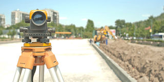
Through its engineering section, RCMRD offers the following important functions to member states:
- Regular service, maintenance, and calibration of all surveying instruments in the government ministries as per the recommended maintenance schedule: RCMRD travels to at least eight countries per year to undertake this, and considers it the best way to keep governments’ surveying instruments in optimal condition, and to ensure their longevity.
- Advisory services to government and parastatal/company practitioners (private entities, universities, technical colleges, and other ministries that use surveying instruments) on where to acquire surveying tools, especially considering after-sales services (training and spare parts).
- Support to other sections in the organisation, like the GIS/Remote Sensing and Survey Section, especially with the use of the CORS (Continuously Operating Reference Station) network.
- Service of survey equipment and calibration training covering the Leveller, Total Positioning System (TPS), Global Navigation Satellite System (GNNS), CORS. The RCMRD service centre is accredited and authorised by Leica Geosystem and GEOMAX Geosystem.
For more information about RCMRD, visit www.rcmrd.org. You may also email [email protected] or call +254723786161 / +254208561673.